
Introduction
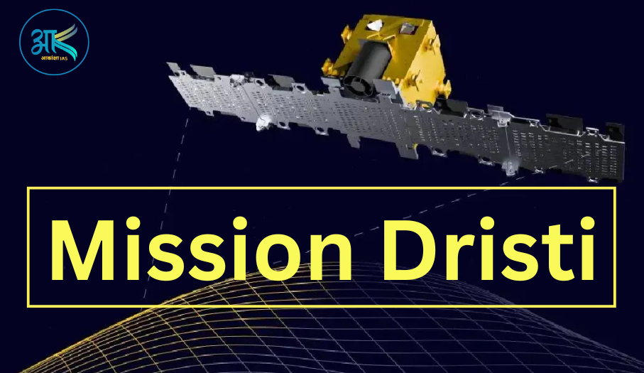
India’s private space sector has achieved a historic milestone with the successful launch of Mission Drishti, developed by Bengaluru-based space-tech startup GalaxEye. The satellite was launched aboard the powerful Falcon 9 rocket from California, marking a major advancement in India’s Earth Observation (EO) capabilities.
Mission Drishti is being hailed as the world’s first OptoSAR satellite, integrating Electro-Optical (EO) and Synthetic Aperture Radar (SAR) technologies into a single platform. This breakthrough innovation places India among the leading nations in advanced satellite imaging and remote sensing technology.
What is Mission Drishti?
Mission Drishti is an advanced Earth Observation satellite designed to provide high-resolution imagery under all weather conditions, during both day and night.
Unlike conventional satellites that rely only on optical imaging, Mission Drishti combines:
- Electro-Optical (EO) Sensors
- Synthetic Aperture Radar (SAR) Sensors
This unique fusion enables the satellite to deliver uninterrupted and highly accurate geospatial intelligence.
The satellite weighs approximately 190 kilograms and offers a 1.5-meter spatial resolution, making it one of India’s most advanced privately developed satellites.
Understanding OptoSAR Technology
Electro-Optical (EO) Imaging
EO sensors capture images using visible and infrared light. These sensors provide:
- High-resolution color imagery
- Detailed terrain mapping
- Urban and infrastructure analysis
- Agricultural monitoring
However, EO sensors face limitations during:
- Cloud cover
- Rainfall
- Fog
- Night-time conditions
Synthetic Aperture Radar (SAR)
SAR technology uses radar pulses instead of sunlight to capture images.
Key advantages include:
- Imaging through clouds and rain
- Night-time monitoring capability
- High reliability in adverse weather
- Accurate terrain and object detection
SAR is widely used for:
- Defence surveillance
- Maritime monitoring
- Disaster response
- Strategic reconnaissance
Why Mission Drishti is Revolutionary
Mission Drishti integrates EO and SAR technologies into a single satellite platform, creating the world’s first OptoSAR system.
This means:
- Better image accuracy
- Continuous monitoring
- Reduced data gaps
- Faster intelligence gathering
- Improved Earth observation capabilities
The integration significantly enhances the efficiency of remote sensing operations.
Technical Specifications of Mission Drishti
| Feature | Details |
|---|---|
| Satellite Name | Mission Drishti |
| Developed By | GalaxEye |
| Headquarters | Bengaluru, India |
| Satellite Type | OptoSAR Earth Observation Satellite |
| Weight | 190 kg |
| Resolution | 1.5 meter |
| Imaging Capability | All-weather, Day-Night |
| Technologies Used | EO + SAR |
| Launch Vehicle | Falcon 9 |
Applications of Mission Drishti
1. Border Surveillance and Defence
Mission Drishti can continuously monitor sensitive border regions and strategic locations.
Benefits:
- Detection of enemy movement
- Monitoring infiltration activities
- Maritime surveillance
- National security enhancement
Its all-weather capability makes it highly valuable for defence agencies.
2. Disaster Management
The satellite can assist governments during natural disasters such as:
- Floods
- Cyclones
- Landslides
- Earthquakes
Key Advantages:
- Real-time damage assessment
- Rescue operation planning
- Flood mapping
- Emergency response coordination
3. Agriculture and Precision Farming
Mission Drishti can improve agricultural productivity through advanced monitoring.
Uses:
- Crop health assessment
- Soil moisture analysis
- Irrigation planning
- Yield prediction
This technology can support India’s growing focus on smart agriculture.
4. Infrastructure Monitoring
Governments and industries can use the satellite for:
- Highway monitoring
- Railway corridor analysis
- Urban expansion studies
- Smart city planning
- Pipeline and power infrastructure monitoring
5. Financial and Insurance Assessment
The satellite’s accurate imagery can help:
- Verify insurance claims
- Assess disaster-related losses
- Perform risk analysis
- Evaluate property and land changes
Importance of Mission Drishti for India
Strengthening India’s Private Space Sector
Mission Drishti highlights the growing capabilities of India’s private space startups. It demonstrates that Indian companies can now develop globally competitive space technologies.
Boost to Atmanirbhar Bharat
The project aligns with India’s vision of:
- Technological self-reliance
- Indigenous innovation
- Expansion of the space economy
Advancing Geospatial Intelligence
High-quality Earth Observation data is essential for:
- Defence planning
- Environmental monitoring
- Urban development
- Climate studies
- Resource management
Mission Drishti significantly strengthens India’s geospatial intelligence ecosystem.
About GalaxEye
GalaxEye is an Indian deep-tech startup focused on next-generation Earth Observation systems.
The company aims to develop:
- Persistent global monitoring systems
- AI-powered geospatial analytics
- Defence-grade satellite imaging solutions
GalaxEye represents the new wave of Indian space innovation emerging after the liberalization of India’s space sector.
Future of India’s Space-Tech Industry
The success of Mission Drishti indicates that India’s private space ecosystem is entering a transformative phase.
With growing government support, startup innovation, and increasing global demand for geospatial intelligence, India is rapidly becoming a major player in the global space economy.
Mission Drishti could pave the way for:
- Advanced satellite constellations
- Real-time Earth monitoring
- AI-enabled surveillance systems
- Commercial remote sensing services
Frequently Asked Questions (FAQs) – Mission Drishti
1. What is Mission Drishti?
Mission Drishti is an advanced Earth Observation satellite developed by GalaxEye. It is considered the world’s first OptoSAR satellite integrating EO and SAR technologies on a single platform.
2. Who developed Mission Drishti?
Mission Drishti was developed by Bengaluru-based Indian space-tech startup GalaxEye.
3. Why is Mission Drishti unique?
Mission Drishti is unique because it combines:
- Electro-Optical (EO) imaging
- Synthetic Aperture Radar (SAR)
This allows the satellite to capture images in all weather conditions, during both day and night.
4. What is OptoSAR technology?
OptoSAR technology combines optical imaging and radar imaging into one satellite system. It provides continuous, high-resolution Earth observation even through clouds, rain, or darkness.
5. What is the weight of Mission Drishti?
The satellite weighs approximately 190 kilograms.
6. What resolution does Mission Drishti provide?
Mission Drishti offers around 1.5-meter spatial resolution, enabling highly detailed Earth imagery.
7. Which rocket launched Mission Drishti?
Mission Drishti was launched aboard the Falcon 9 rocket from California.
8. What are the major applications of Mission Drishti?
Mission Drishti can be used for:
- Border surveillance
- Defence operations
- Disaster management
- Agriculture monitoring
- Infrastructure analysis
- Financial and insurance assessment
9. How does SAR technology help Mission Drishti?
SAR technology uses radar pulses instead of sunlight, allowing the satellite to:
- Capture images at night
- See through clouds and rain
- Operate in all weather conditions
10. How is Mission Drishti important for India?
Mission Drishti strengthens India’s:
- Private space sector
- Defence surveillance capability
- Geospatial intelligence systems
- Technological self-reliance under Atmanirbhar Bharat
11. Is Mission Drishti India’s first private Earth Observation satellite?
It is among India’s most advanced privately built Earth Observation satellites and is regarded as India’s largest privately developed high-resolution satellite.
12. How can Mission Drishti help in disaster management?
The satellite can provide:
- Real-time flood mapping
- Cyclone tracking
- Damage assessment
- Rescue operation support
13. How will Mission Drishti support agriculture?
Mission Drishti can help farmers and governments through:
- Crop health monitoring
- Soil moisture analysis
- Precision farming
- Irrigation planning
14. What is the significance of EO sensors in Mission Drishti?
EO sensors capture detailed visual imagery in daylight and clear weather conditions, helping in mapping, urban planning, and environmental monitoring.
15. What is the future significance of Mission Drishti?
Mission Drishti represents the future of intelligent Earth observation systems and could pave the way for:
- Advanced satellite constellations
- AI-based geospatial analytics
- Real-time global monitoring systems
- Enhanced commercial satellite services